
Unity Explains the Trade-Offs Behind Heightmaps, Voxels, and Game Terrain
A new Unity learning article dated October 27 compares common terrain approaches, including heightmaps, voxel grids, tiles, and procedural noise. It is an educational guide, not an announcement of a new engine feature.
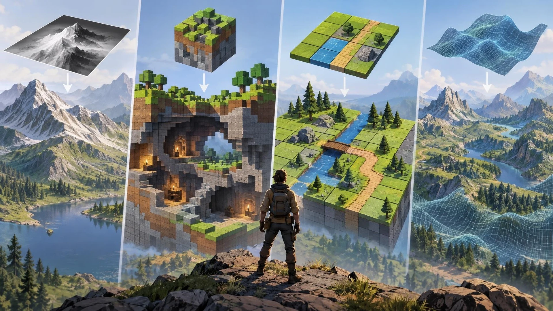
Terrain can determine the structure of a game long before lighting and decoration make a world look finished. A mountain can guide movement, a valley can hide an objective, and the placement of a cave may define an entire mission. Unity has published a beginner-focused guide explaining several methods used to construct those landscapes.
The article, released on October 27, 2026, covers tile-based environments, heightmaps, voxel terrain, and noise-based procedural generation. Its aim is to help creators understand why different terrain techniques are useful rather than present a new component of the Unity engine.
Heightmaps are a common starting point for three-dimensional landscapes. A grayscale image determines elevation across a surface, allowing an engine to turn a flat grid into hills, slopes, and valleys. This representation can be efficient and familiar to terrain artists, but it cannot directly represent a cave beneath an overhang because each location on the surface has a single height.
Voxel approaches solve a different problem by representing occupied and empty space in three dimensions. That makes destructible ground, tunnels, and overhanging geometry possible. The trade-off is that a voxel system can be more complicated to store, modify, render, and optimize. A project should adopt that complexity because its gameplay needs the flexibility, not simply because voxels sound more advanced.
Tiles are often a strong choice for grid-based or two-dimensional worlds. Procedural noise, meanwhile, can introduce controlled variation and produce broad landscapes from mathematical rules. But procedural methods still require design judgment. A generated hill that blocks a required route or makes objectives impossible to find is not automatically a useful game environment.
For developers using Unity, the most productive experiment would compare two small terrain representations around the same gameplay goal. Build a heightmap-based outdoor area with a clear path between two objectives, then sketch how the design would change if players needed to dig tunnels or alter the landscape during play.
The comparison should include player navigation, collision behavior, runtime performance, memory use, and the time required to author the scene. A striking screenshot alone cannot reveal whether the terrain supports the intended mechanics. The team should also test on its intended hardware rather than assuming a desktop development machine represents a mobile device.
Unity's guide is a useful reminder that worldbuilding is a systems decision as much as an art decision. Choosing a terrain representation early can reduce costly redesign later, particularly in survival, exploration, construction, and open-world games.
Rate this story
What did you think of this article?
Log in to rate this story, comment and like replies.
Log inNo comments yet. Be the first to share your thoughts.
More stories

Unity CLI Beta 15 Adds Project Audits and Long-Running MCP Jobs
Unity CLI 1.0.0-beta.15 introduces project auditing, offline documentation access and MCP job controls aimed at automated workflows. The October 29 release also changes command output and removes some earlier commands, requiring script updates.

New Community Toolkit Packages Epic’s Game Animation Sample as a Reusable Plugin
A tutorial published October 29 presents a community-built process for converting the Game Animation Sample into an updateable Unreal Engine 5.8 plugin, with configuration safeguards and backup steps designed for existing projects.
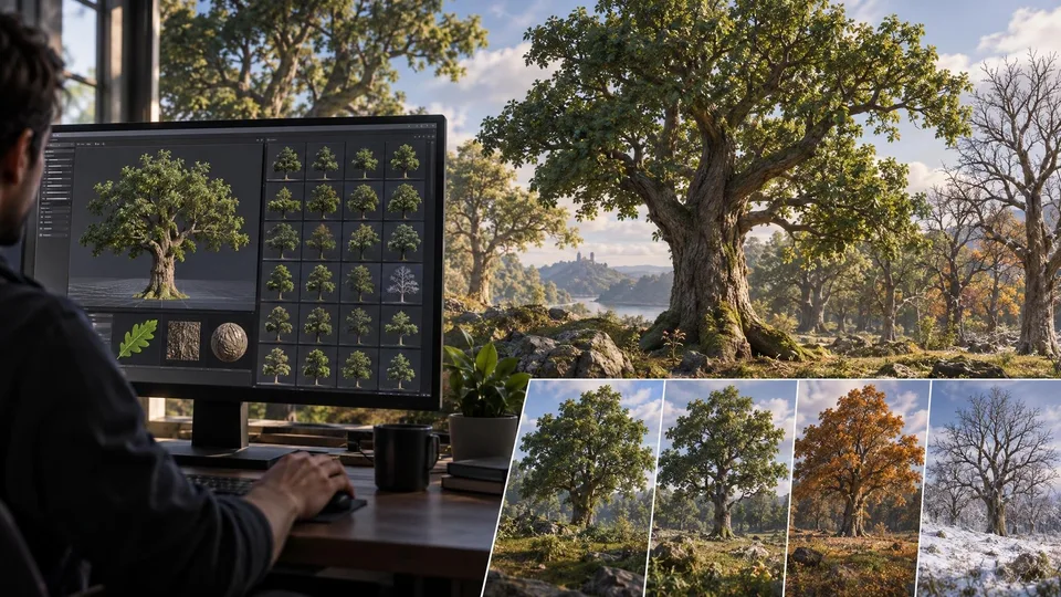
New Procedural Oak Asset Pack Offers 52 Unreal Engine 5.8 Tree Variants
Greenleaf Vision has introduced an English oak preset collection for Unreal Engine 5.8’s experimental Procedural Vegetation Editor. The creator lists 52 variants based on terrestrial laser scans, with custom leaves and bark.
Comments