
Open-Source Eclipse Simulator Combines Unreal Engine 5, Cesium and Python
An independent developer has shared a free open-source solar eclipse simulator using Unreal Engine 5, Cesium geospatial terrain and a Python astronomy backend. The showcase illustrates a reusable architecture for scientific visualization, not a new engine capability.
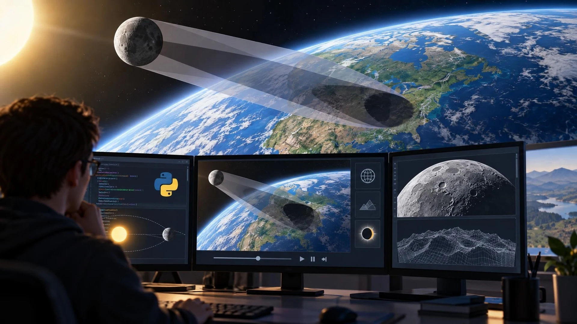
A new independent project is showing how Unreal Engine can present scientific data as interactive three-dimensional geometry. On November 4, 2026, a solo developer introduced 3D Solar Eclipse Simulator, an open-source application built with Unreal Engine 5, Cesium for Unreal and a Python astronomy backend.
The project's central idea is to display the Moon's umbra and penumbra as actual three-dimensional shadow cones rather than drawing only a flat eclipse track on a map. It places the resulting geometry against an Earth representation based on the WGS84 ellipsoid and Cesium geospatial terrain. The developer uses Skyfield and JPL DE441 ephemerides for astronomical calculations.
The author reports a catalog containing more than 71,000 solar eclipses and 72,000 lunar eclipses over a period of roughly 30,000 years. The application includes a free-flight camera, saved locations, time controls and astronomical details such as contact times. A custom UDP communication path connects Python calculations with Unreal's real-time rendering. These counts and validation results come from the creator's own description.
The project provides a useful architectural example for other developers. Python can handle a specialized domain calculation while Unreal Engine focuses on visualization and interaction. That separation can make sense when an existing scientific library offers capabilities that would take substantial effort to recreate in C++. The tradeoff is maintaining a reliable boundary between processes, including communication, synchronization and error handling.
Another notable feature is a compact neural network used to model lunar surface elevation from NASA-derived measurements. This is an application-specific numerical technique, not a general AI model that automatically builds Unreal Engine environments or gameplay systems.
For a practical experiment, a developer could create a much smaller Cesium-based visualization driven by synthetic position data. Update one sphere or marker through a controlled interface, then verify coordinate units, world origin handling and update rate. After that, profile how often data can change before communication or rendering becomes a bottleneck.
Those tests are particularly relevant when visualizing large real-world areas. A geographically accurate position can be difficult to manage if a simulation mixes different coordinate conventions or ignores floating-point precision over large distances.
The project has been presented as free and open source under Apache License 2.0. Developers should still check licenses for individual third-party dependencies and geographic datasets before reusing them elsewhere.
The release is a community showcase, not an Unreal Engine update. Its main lesson is how a game engine, geospatial plugin and separate computational backend can form a coherent interactive application beyond conventional games.
Rate this story
What did you think of this article?
Log in to rate this story, comment and like replies.
Log inNo comments yet. Be the first to share your thoughts.
More stories
Fortnite Ecosystem 43.00 Brings PCG and New MCP Tools to UEFN
Epic has released Fortnite Ecosystem 43.00 with editor-time PCG, new UEFN MCP capabilities and a production-ready quest Progression API. The changes apply to the Fortnite creator environment, not automatically to conventional Unreal Engine projects.

Epic Previews Cesium, Mesh Terrain and Unreal MCP Demos for I/ITSEC 2026
Epic Games has outlined its Unreal Engine 5.8 simulation showcase for I/ITSEC in Orlando. The announced demonstrations cover geospatial visualization, experimental Mesh Terrain, procedural worlds and AI assistants connected through Unreal MCP.

OpenAI Announces Pierre Acquisition to Expand Codex Git Workflows
OpenAI plans to acquire Pierre Computer Company, whose open-source file-tree and code-diff libraries already appear in Codex. The announcement focuses on future developer workflows and is not yet a newly shipped game-engine integration.
Comments